Term 2 - Weeks 4+5
Section outline
-

EXPLORE / TŪHURA learning intentions:
- We are EXPLORING...weather patterns by collecting and calculating weather data and interpreting the shape/size/colour of clouds
- We are EXPLORING...weather patterns by analysing weather maps to recognise and plan for weather events
Learning Intentions:
Investigate weather maps and extreme weather events so we can adequately prepare and respond.
Success Criteria: I can/have...
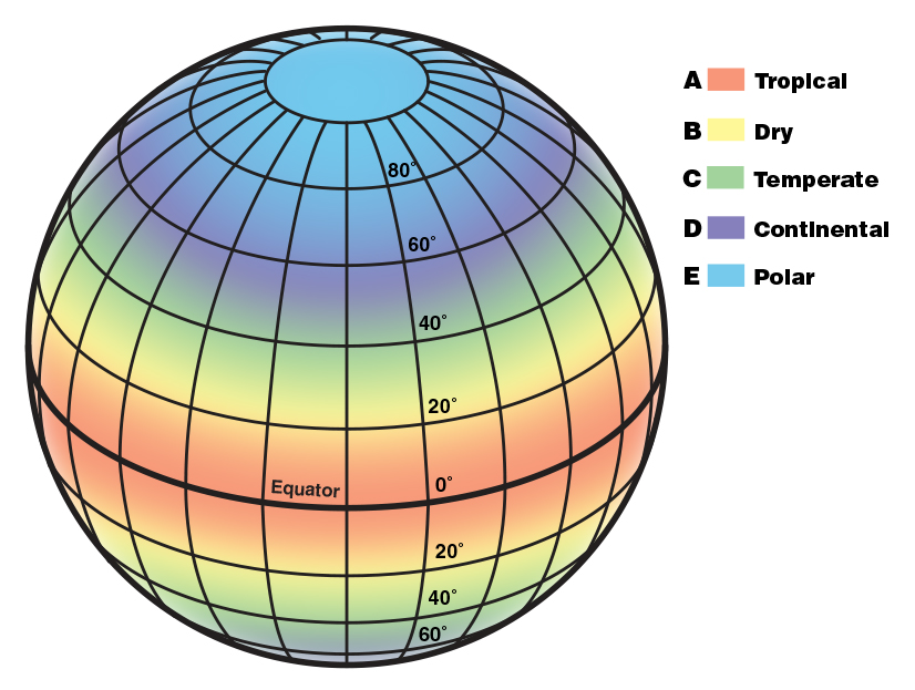
- Compare and contrast climate and weather
- Identify and describe the weather of different climate types around the world
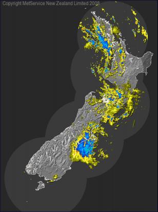
- Read a weather map including,
- Identifying warm and cold fronts
- Identifying high and low pressure systems
- Explain what causes these weather events using an understanding of the water cycle, temperature, and currents
- Key words: climate, climate types (tropical, dry/arid, temperate, continental, polar), warm and cold front, isobar
Activities:
- Class notes + activities: Google Slides (shared), BrainPop, EdPerfect
- Literacy: National Ocean Service weather vs. climate, research climate types to draw conclusions on weather in the different climates
- Numeracy: Reading, interpreting and practice drawing weather maps
- Hands-on: Understanding currents and how the water cycle leads to weather events