Term 3 - Week 1
Section outline
-
Learning Outcome:
Read a Topographical map so we can locate where our waterways start and stop, and how they align with the earth's features
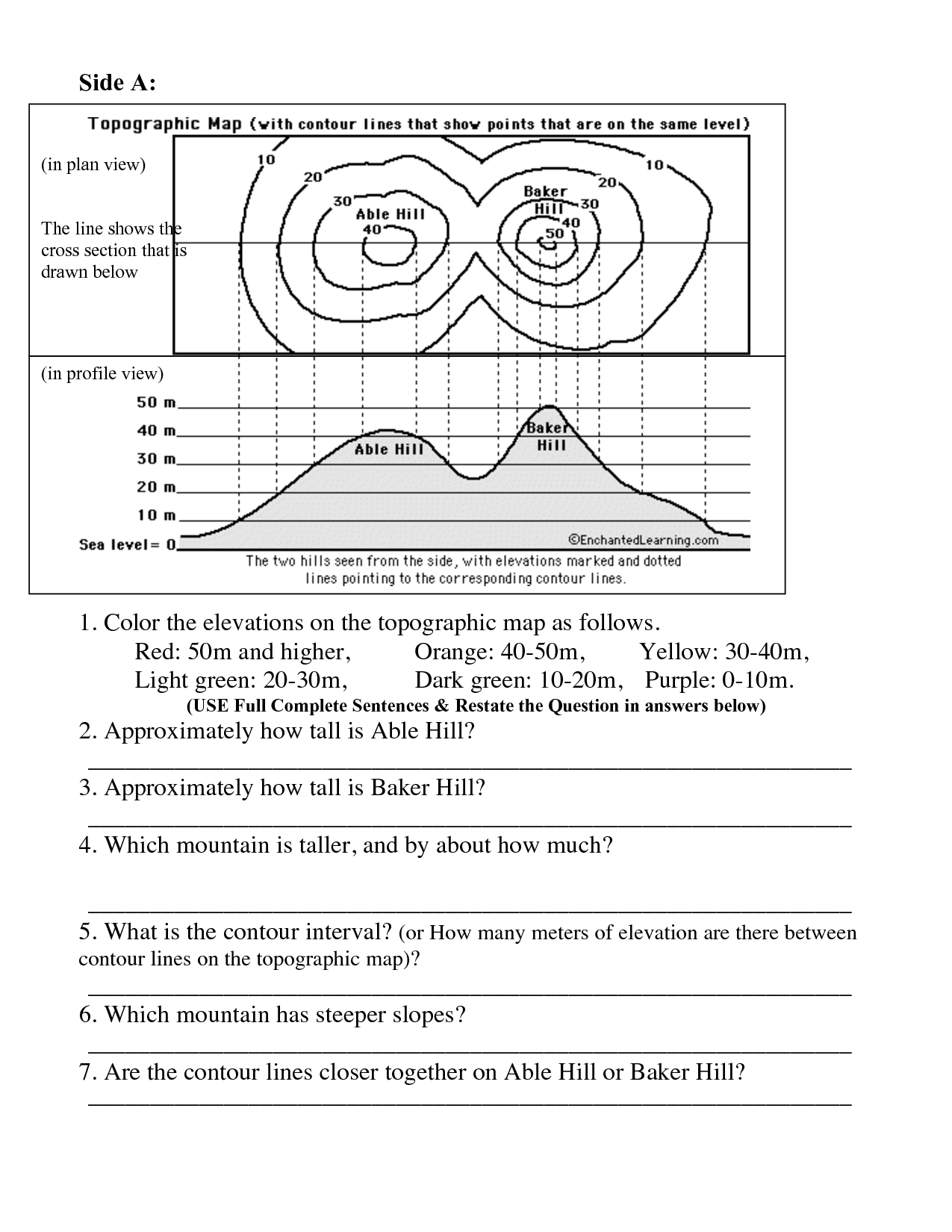
Success Criteria:1. Read the following on a topographical map: contour lines, index line, scale and symbols (legend) to describe what the earth's surface would look like
2. Make your own mountain and create a topographical map for it.

EXPLORE / TŪHURA learning intentions:
- We are EXPLORING...how the earth's surface forms bodies of water by analysing topographical maps
- We are EXPLORING...water quality by classifying macro-invertebrates, collecting and calculating data, and observing different bodies of water
-
-
For those interested in how to make play dough, here's the recipe used to for our mountains activity.