20 July - 26 July
Section outline
-

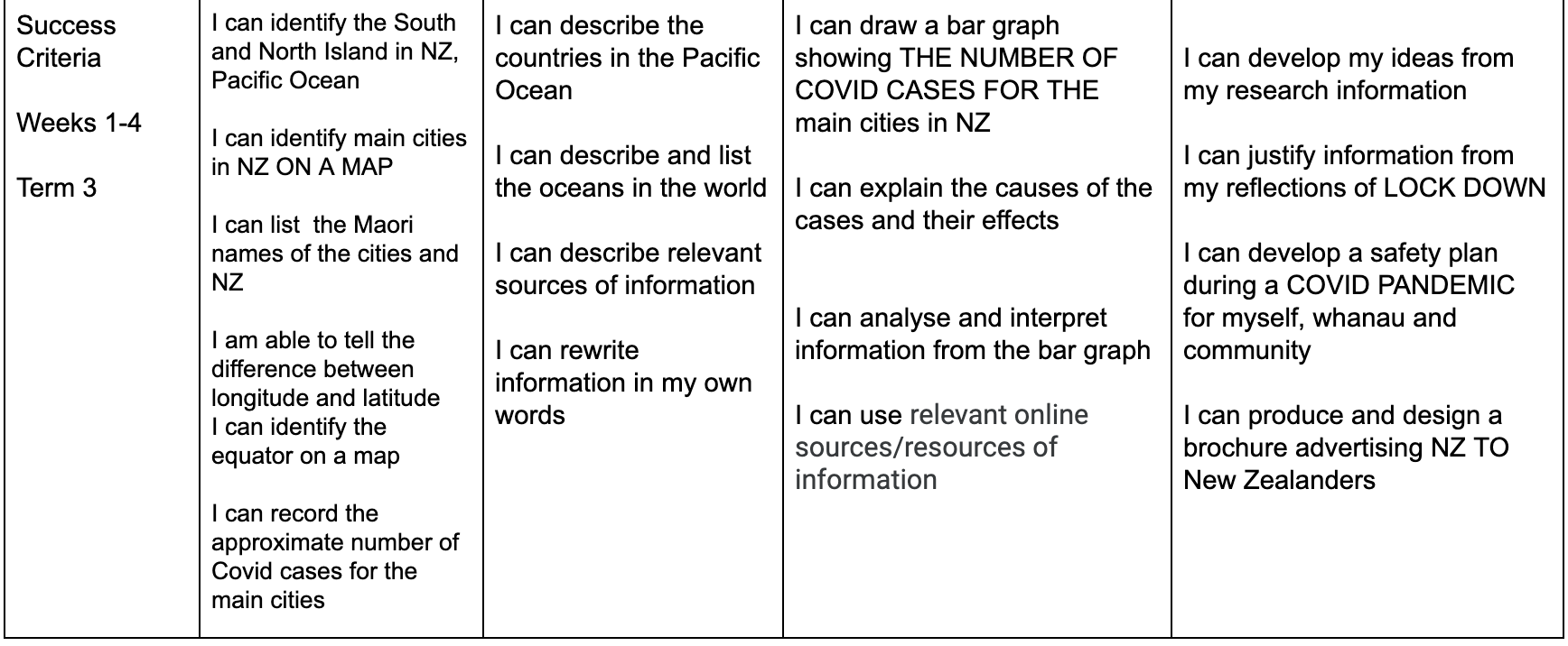
PLAN & DO / WHAKAMAHI learning intentions:
- We are PLANNING to demonstrate our mapping skills so that we can justify where specific locations are in NZ
- We are PLANNING to construct a bar graph so that we can present our COVID cases by region in NZ
- We are PLANNING to collaborate our findings so that we can share our information with our class
- We are PLANNING to apply our experience of LOCKDOWN so that we can plan and create our brochure
Activities:
1. On a blank map of NZ mark in the main cities, South Island and North Island.
2. Define longitude and latitude, equator and identify on a map.
3. List the Maori names for Auckland, Wellington, Hamilton, Christchurch, Dunedin and Queenstown.
4.Locate the Pacific Ocean, name 5 countries that are surrounded by the Pacific Ocean.
5. Describe and list the oceans of the world.
Extra:
Username: MHJC
Password: 1student
https://kids.nationalgeographic.com/explore/countries/
EDUCATION PERFECT Tasks-Graphs and longitude and latitude